
Manchester, MA to Gloucester, MA
I put in at the Manchester Public Ramp behind Town Hall on MA127. Passing under the bascule bridge which carries the MBTA Commuter Rail, I traversed the harbor and rounded Gales Point. I followed the coast past Singing Beach and Magnolia Harbor to reach Gloucester Harbor. I landed (illegally, I believe, but the lifeguard let me stay) at Stage Head Beach for lunch, then crossed the busy channel to Ten Pound Light and headed south to Eastern Point Light. I once again navigated the channel (exercise extreme caution while paddling Gloucester Harbor on a summer weekend) and paddled back along the coast to Manchester Harbor. In total, I covered about 16 nautical miles.
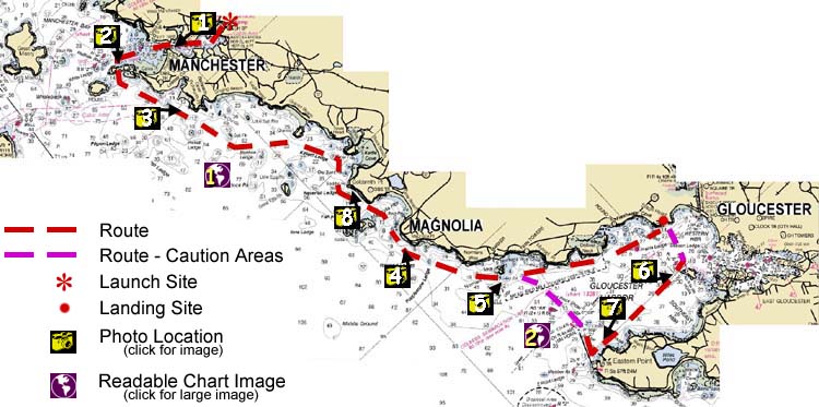
Image descriptions are keyed to the map above; you can also click on the map to see the image
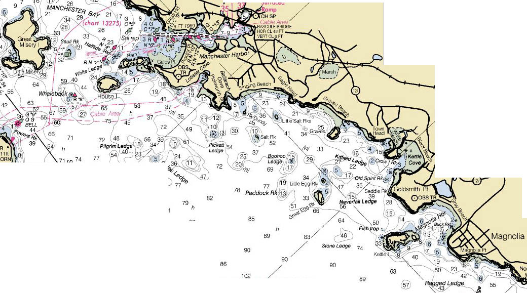 |
Manchester to Magnolia: high-resolution nautical chart (169kb) |
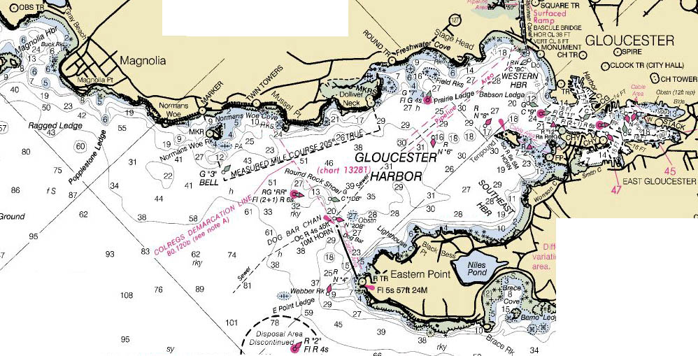 |
Magnolia to Gloucester: high-resolution nautical chart (171kb) |
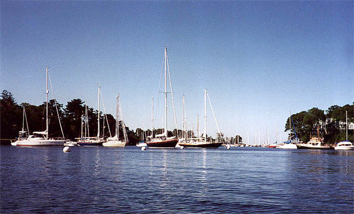 |
Moorings in Manchester Harbor |
 |
Gales Point, Manchester |
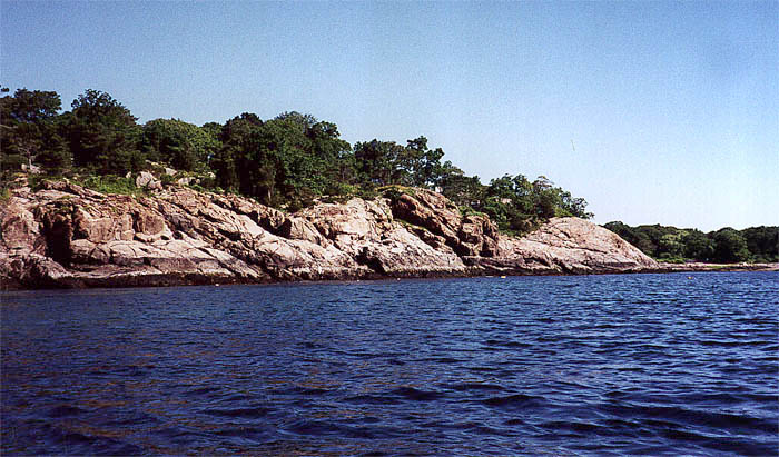 |
Pickworth Point, Manchester |
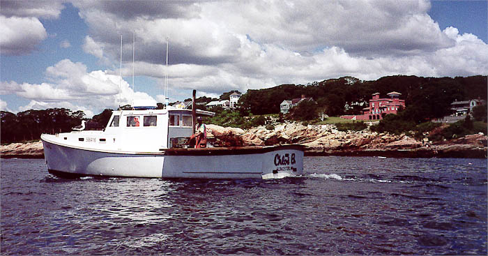 |
Lobster boat at Magnolia Point, Magnolia |
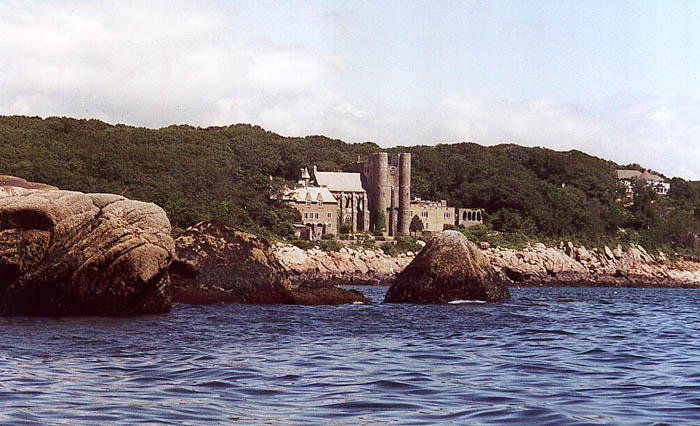 |
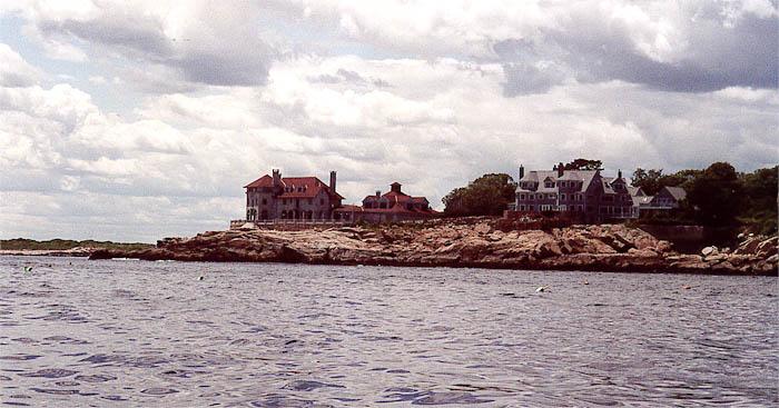
Norman's Woe Rock and Hammond Castle, Gloucester |
 |
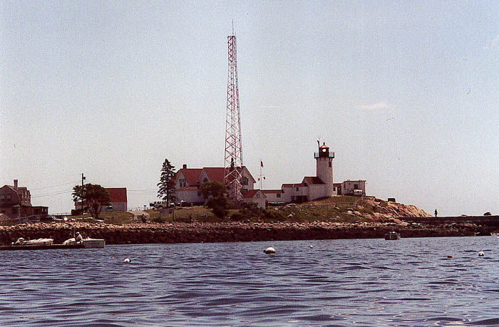
Ten Pound Light, Gloucester |
 |
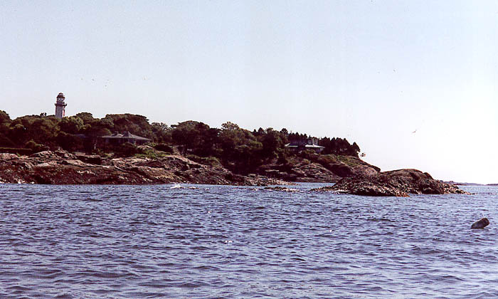
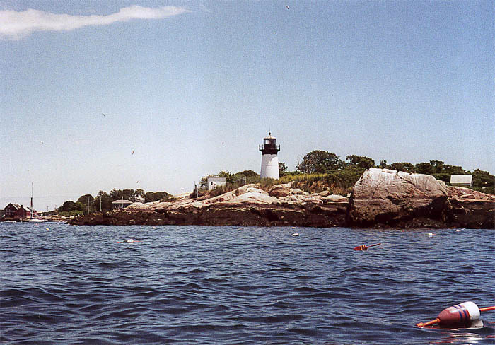
Eastern Point Light, Gloucester |
 |
Goldsmith Point, Magnolia |


You are visitor number
© 2000 Daniel E. Smith. Last updated 8-13-00